Coolgardie West
Coolgardie West Project (LSR 100%)
E15/2013 is a prospective tenement for Au, Ni and Li, of 59sq km in area and located 7km west of Coolgardie in the Eastern Goldfields region of Western Australia.
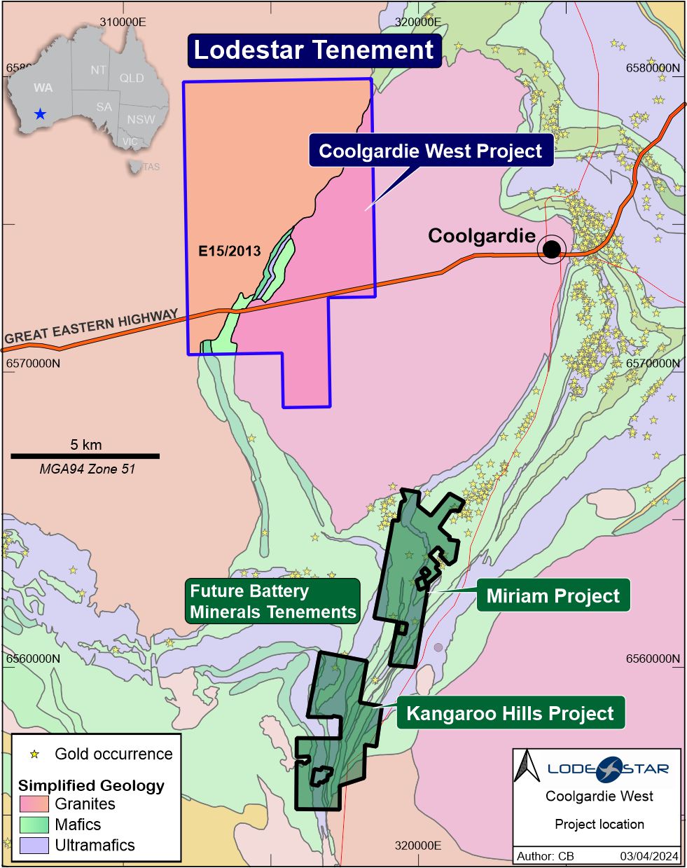 E15/2013 location map on geological and gold occurrence background. LSR also has shares* and performance rights in Future Battery Minerals who have nearby lithium projects. *Check latest LSR announcement for updated values.
Multi‐element geochemistry (UFF™) was completed over E15/2013, in the area where the Coolgardie greenstone belt is deflected around the western margin of the Calooli monzogranite. The 5km long greenstone is prospective for gold, nickel and LCT pegmatite mineralisation. 1114 soil samples were collected over the tenement area including the greenstone and margins, defining two large gold anomalies related to the greenstone belt and to structural features in the aeromagnetic imagery.
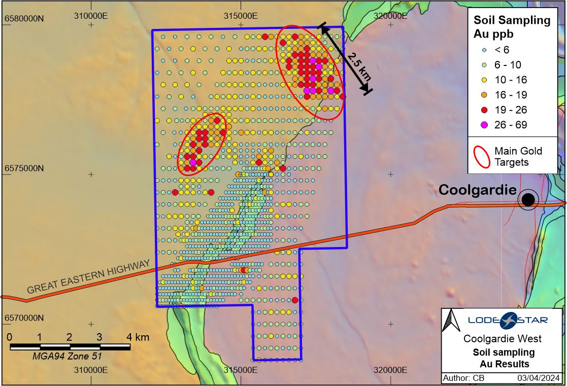 Gold anomalies over aeromagnetic TMI image and GSWA 1:500,000 scale interpreted bedrock geology
The gold anomalies peak at 69ppb Au and currently cover over 3km strike length each. Limited historical RAB drilling at the southern margin of Lodestar’s northern anomaly has intersected wide intervals of volcanic rocks (mafic and ultramafic rocks) rather than granites so this increases the Au prospectivity of the host rocks which have been incorrectly interpreted previously due to a sandy cover of soil in this area. This sandy cover is likely to have diluted the geochemical response in conventional soil sampling techniques.